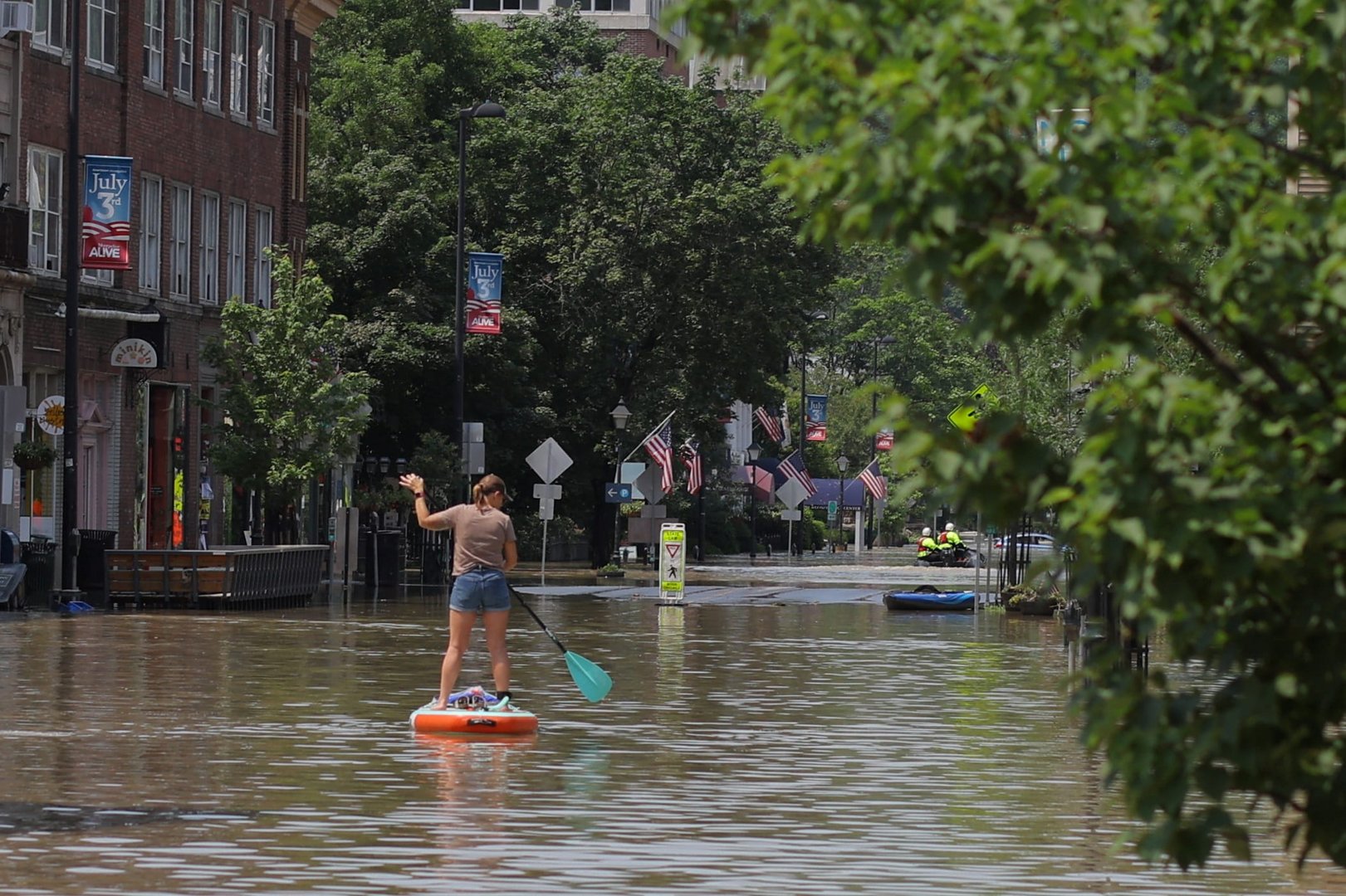
A Vermont reservoir threatened to overwhelm a dam protecting the state’s capital on Tuesday and exacerbate “catastrophic” flooding that has already shut roadways leading out of town and trapped some residents in their homes.
Early on Tuesday morning, the Wrightsville Dam, which forms a reservoir four miles (6.4 km) north of Montpelier, had 6 feet (1.8 meters) of storage capacity remaining, city manager William Fraser wrote on Facebook.
Once the limit is crossed, a spillway would release water into the North Branch of the Winooski River, he warned, aggravating what the National Weather Service is describing as “catastrophic” flooding in downtown Montpelier, where the North Branch converges with a second, larger branch of the Winooski.
Fraser urged the city’s 8,000 residents to be prepared to move to the upper floors of their homes as highway closures made evacuations difficult or impossible.
Montpelier Fire Chief Robert Gowans said rescue teams in boats have reached about a dozen people stranded in homes and vehicles in the city, where more than 7 inches (18 cm) of rain has fallen over the last two days.
“But right now the sun is out and the river is receding,” Gowans said, noting an inspector is keeping a watchful eye on the dam. “Hopefully the worst is over.”
As of 10:45 a.m. EST, the Winooski River in Montpelier was at 21.2 feet (6.46 m), slightly below the maximum height it reached earlier in the morning. Downtown flooding was expected until late afternoon, when the river could recede to below 15 feet, the National Weather Service said.
Video footage from Fox Weather showed flood waters had reached the windows of businesses and the tops of vehicles in Montpelier’s picturesque downtown district.
“This has never happened since the dam was built so there is no precedent for potential damage,” Fraser wrote. “This will be particularly bad along the North Branch River corridor and into the downtown.”
No casualties have been reported in Vermont thus far.
Vermont officials were calling the flooding the worst since Hurricane Irene reached the New England state as a tropical storm in 2011 and caused about $750 million in damages and seven deaths in the state.
Montpelier City Council member Conor Casey said the city’s topography – bordered by hills with the downtown in a valley – increases the potential for flooding.
“My wife and I live right on the river and it’s about two feet from coming in the living room,” he said. “We’re a bit used to it from Irene, so it’s not totally foreign, but I think the scary thing is that it feels a bit worse so far.”
BILLIONS OF DOLLARS IN DAMAGE
On a preliminary basis, private forecaster AccuWeather estimated damages and economic loss from the current floods at $3 billion to $5 billion, based on its own method of evaluation.
Many parts of the region, including northeastern New York, Massachusetts and Connecticut, have already had as much as 8 inches (20 cm) of rain over the last several days. The torrential rains caused raging flood waters to swell rivers and streams, rush through small towns and force the closure of major roadways.
Most of the crops at Boyd Family Farm in Wilmington, Vermont, were lost in the storm, said Janet Boyd, who owns the business along with her husband and son.
The farm, tucked in the southern end of the Green Mountains, has been in operation in the family for 80 years, and Boyd is worried about its future.
“We lost all the vegetables and only have our blueberries left,” Boyd said, “all the greens, the tomatoes, the peppers, the garlic.”
The Winooski is one of three major Vermont rivers that were cresting on Tuesday morning at or near record levels, said Weather Service forecaster Marlon Verasamy.
In Johnson, in central Vermont, the Lamoille River was at 21 feet, some 5 feet above its normal flood stage, he said.


Click here to change your cookie preferences