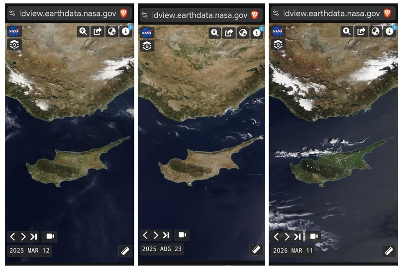
Satellite imagery released by NASA’s earth observation tools highlights significant changes in the landscape of Cyprus over a one-year period, with conditions in March 2026 appearing notably greener than the same time last year.
The comparison, published on Monday, is based on three images captured on March 12, 2025, August 23, 2025 and March 11, 2026.
The image taken in March a year ago shows the island with widespread green vegetation following winter conditions, while the August 2025 image reflects the impact of summer drought, with terrain appearing barren as vegetation dried out after prolonged heat and limited rainfall.
By contrast, the March 2026 image shows an apparent lush landscape across the island, following a period of significant rainfall.
NASA’s earth observation imagery is widely used to monitor environmental changes, including vegetation health, water availability and land use patterns.


Click here to change your cookie preferences