A wild Wednesday of weather and seismological activity saw Cyprus struck by two earthquakes measuring above five on the Richter scale, while large swathes of the island were also hit by heavy rain, floods, and storms.
The first earthquake struck shortly after 11.30am, and measured 5.3 on the Richter scale, with its epicentre in the Paphos district village of Ayia Marina.
While no serious structural damage was recorded, people were seen exiting office buildings and homes as a precaution in the aftermath of the quake, with Ayia Marina mukhtar Marios Stylianou confirming that the epicentre village had escaped unscathed, and that its elderly residents are “well”.
Paphos district governor Charalambos Pittokopitis had said that the earthquake had caused rocks to fall on the road between the town of Paphos and the nearby village of Tsada.
Problems were also reported on Cyprus’ telecommunications networks, with the Cyprus telecommunications authority (Cyta) reporting that there had been “unexpected, particularly increased traffic” on the network, and that as such, there had been “a few minutes of network congestion”.
“Cyta services which were affected for a few minutes are already operating normally,” Cyta said shortly after 1pm.
Meanwhile, civil defence spokesman Panayiotis Liasides confirmed during an appearance on television channel Alpha that there had been “no reports of serious damage or injuries”, and that there had been “small landslides but nothing serious”.
He added that the civil defence is “monitoring the situation”, and said that in the event of an earthquake, people should move to an open area and stay away from power lines where possible, before later saying that people should “be calm, avoid panic, and protect themselves”.
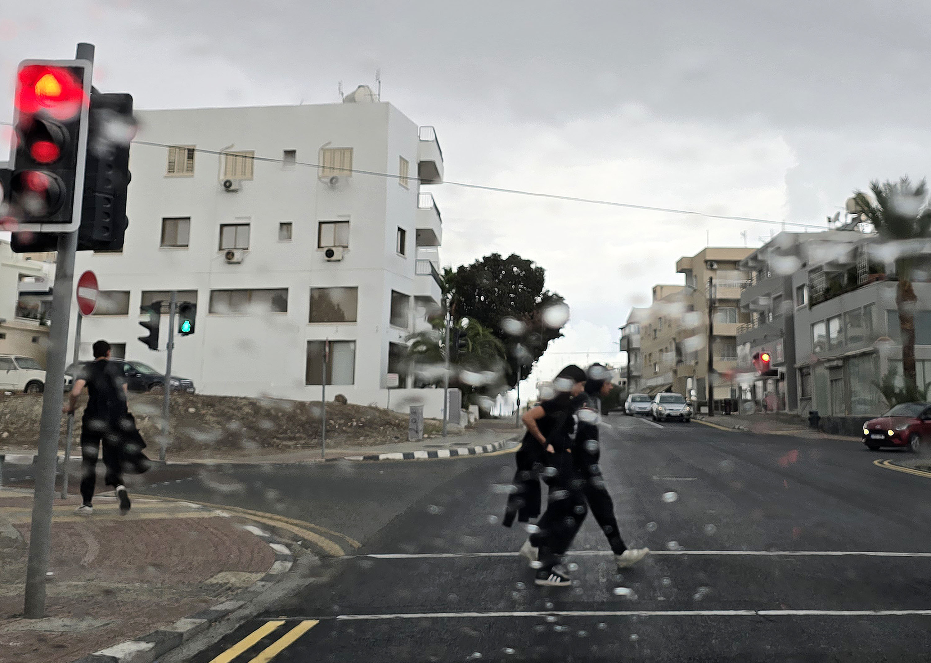
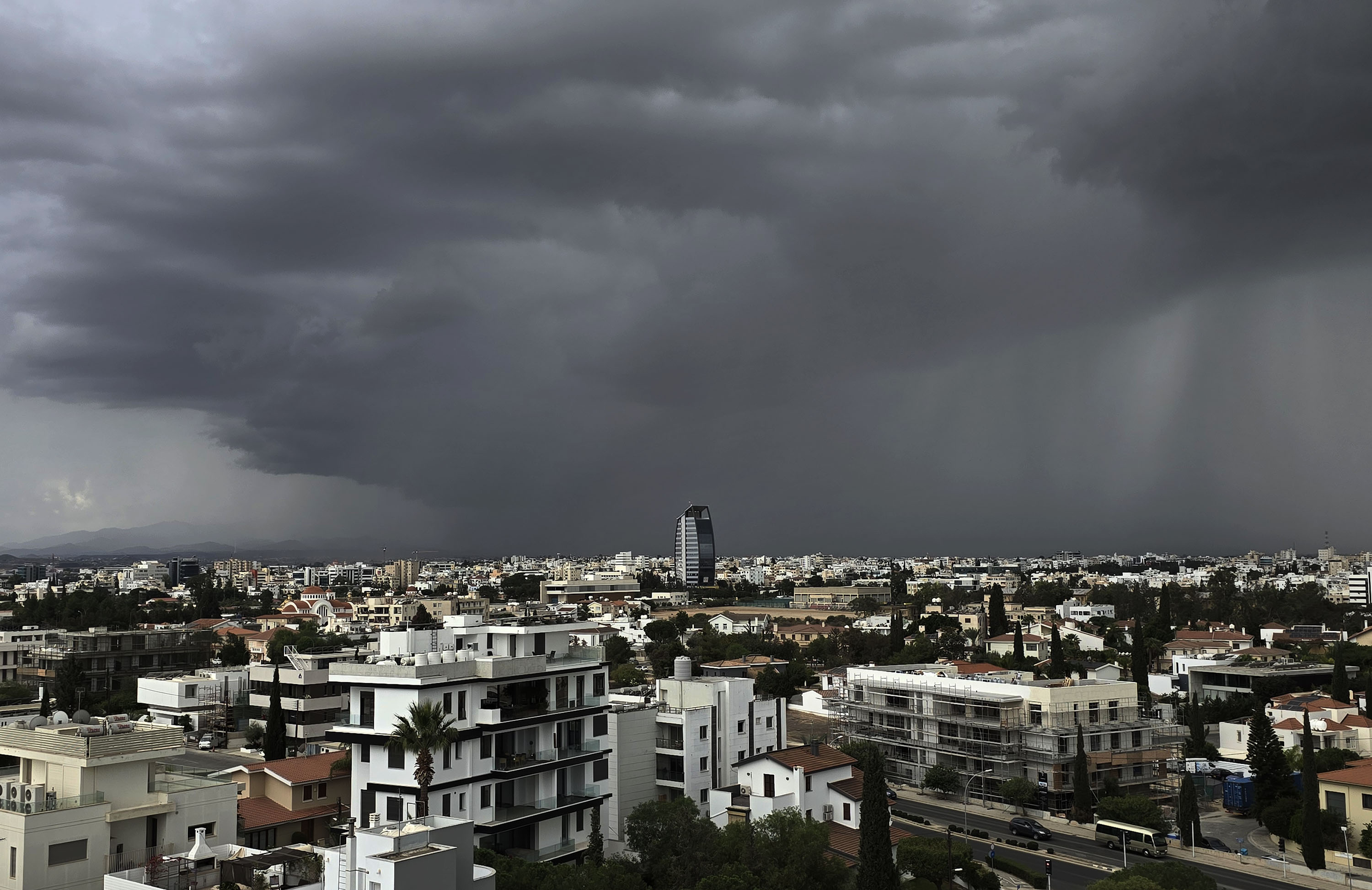
Just as calm had been restored, the heavens opened, with heavy rain falling in Nicosia, in other inland areas, and in the northern foothills of the Troodos mountains during the early afternoon.
The rain caused flash flooding on roads across the capital, with streams of water running down streets and arterial roads alike, while swathes of the suburbs of Engomi and Strovolos were left without power.
In the suburb of Lakatamia, meanwhile, children on a school bus found themselves marooned on a flooded road, with the fire brigade having to intervene to safely remove them, while Erithros Stravros street and Alexandroupoli Street in Strovolos, both of which traverse the Pedieos river, were closed by the police.
Fire brigade spokesman Andreas Kettis said on Wednesday evening that more than 60 calls were made to the fire brigade for help during the storms, with most of those calls being requests for drains to be opened and for water to be pumped away from roads.
With large parts of the island now drenched, the day drew to a close with a second powerful earthquake, once again measuring 5.3 on the Richter scale, shortly after 4.30pm.
Geological survey department director Christodoulos Hadjigeorgiou told the Cyprus News Agency that the second major earthquake had been “slightly weaker” than the first, though he did stress that there had been “a series” of smaller tremors throughout the day, and that the phenomenon “needs to be studied”.
He added that tremors were expected to continue through the night, and that the geological survey department’s seismological centre would continue to monitor the situation.
The second strong earthquake also had its epicentre in the Paphos area.
According to the Euro-Mediterranean seismological centre, more than 30 tremors were detected in Cyprus throughout Wednesday, two of which had magnitudes between four and five on the Richter scale.
Meanwhile, Greece’s earthquake planning and protection organisation chief Efthymios Lekkas urged caution in the next 48 hours “because the nature of the faults is not always known”.
“We know that faults exist and intersect the terrestrial space. However, we do not know the faults which are located in the underwater space and how these faults are connected to one another,” he said.
He also said that the boundary of the African and Anatolian tectonic plates and the “Cyprus Arc”, a curved plate boundary to the south of the island where the African plate subducts under the Anatolian plate, “can cause a noticeable earthquake”, potentially measuring as high as eight on the Richter scale.
“According to historical data, we may have an earthquake measuring eight on the Richter scale, but this is a very, very extreme case. In 365 AD, there was a magnitude eight earthquake in Kourion, near Limassol, where southern Cyprus was completely destroyed,” he said.
Despite this, he said, smaller earthquakes are more likely, with the 1996 Paphos earthquake, which measured 6.8 on the Richter scale, appearing more likely to be repeated.
In the 1996 earthquake, two people were killed by secondary causes, while in an earthquake of similar magnitude – 6.6 – in 2022, a total of 1,586 chickens were killed in the Paphos district village of Kallepia after panic among the flock induced a stampede.


Click here to change your cookie preferences